وثيقة
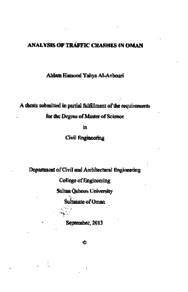
Analysis traffic crashes in Oman
الناشر
Sultan Qaboos University
ميلادي
2013
اللغة
الأنجليزية
الملخص الإنجليزي
The main goal of the research was to analyze Oman's traffic crash data and use Geographic Information System (GIS) techniques to identify the high severity traffic crashes areas or black spot locations in the Governorate of Muscat.
Oman's traffic crash data for eleven years, from 2000 to 2010 were collected from police reports and statistics. Data on black spots in the Governorate of Muscat for five years from 2006 to 2010 were also collected.
The collected data were categorized and analysed and the black spots locations were identified and processed using GIS Environment. GIS-based black spots location maps were also plotted for each of the five Muscat Willayats (Qurayyat, Greater Muttrah, Bawshar, As Seeb, and Al Amerat).
Data revealed that human factors were responsible for 97% of all traffic crashes. By using the GIS technologies, it was concluded that the black spots were mostly located on major roads, junctions, intersections, bridges and roundabouts.
Based on literature search of best practices to combat the escalation of traffic crashes, it was recommended to apply certain practical measures to tackling road crash problems in Oman. Such measures include the application of the advisory Intelligent Speed Adaptation (ISA), effective deterrents, and awareness campaigns in combination of strict police enforcement of traffic laws.
The research recommends a complete and an in-depth survey of the worst black spots locations and the remaining black spots obtained in each Willayatt, the survey should include the geometry of the existing junctions, intersections, bridges, and roundabouts along with the traffic control devices installed at these sites in order to develop technical and operational solutions. Traffic safety data should be more detailed and should contain detailed information related to the causes of the crashes, exact location, involvements, and injuries in order to make any future research studies in Oman meaningful and easier to conduct.
المجموعة
URL المصدر
الملخص العربي
الهدف في الأطروحه الحاليه هو تحليل توزيع الحوادث المرورية في سلطنة عمان واستخدام تقنية نظم المعلومات الجغرافية (GIS) لتحديد أماكن وقوع الحوادث الجسيمة أو النقاط السوداء في محافظة مسقط تم تجميع بيانات الحوادث المرورية للسلطنة لمدة ۱۱ سنة من ۲۰۰۰ الی ۲۰۱۰ واماكن النقاط السوداء لمدة خمس سنوات من ۲۰۰۹ الی ۲۰۱۰
تم تحليل بيانات الحوادث المرورية وادخال أماكن النقاط السوداء في بيئة ال (GIS) وعمل خرائط للخمس ولايات التابعة لمحافظة مسقط (قريات، مطرح الكبری، بوشر، السيب، العامرات) لكل سنة ولكل بيان. وبعد أن تم التحليل والحصول على الخرائط تم استنتاج أن العامل البشري هو المسئول عن وقوع الحوادث المرورية بنسبة تتجاوز ۹۷% من المسببات ، كما أن استخدام تقنية (GIS) تلخص في أن اكثر اماكن الحوادث تقع في الطرق الرئيسية والتقاطعات والدوارات والجسور. نتيجة الأطروحة تلخصت بأن يتم استخدام أجهزة ضبط السرعة مثل (ISA) وتشديد العقوبات المرورية ونشر الوعي المروري بين أفراد المجتمع بالإضافة إلى مراجعة ودراسة الناحية الهندسية (الفنية) لاماكن النقاط السوداء. اقترحت الاطروحة عمل دراسة متعمقة لاماكن النقاط السوداء ذات الأولوية ويتبعها باقي النقاط السوداء لايجاد الحلول الفنية والعملية لها ، كما اقترحت ان تكون البيانات المرورية الإحصائية أكثر تفصيلا من حيث اسباب الحادث وموقعه بالضبط واعداد المصابين والمتأثرين جراء الحادث حتى يسهل عمل الدراسات المستقبيله لذات الموضوع في سلطنة عمان.
تم تحليل بيانات الحوادث المرورية وادخال أماكن النقاط السوداء في بيئة ال (GIS) وعمل خرائط للخمس ولايات التابعة لمحافظة مسقط (قريات، مطرح الكبری، بوشر، السيب، العامرات) لكل سنة ولكل بيان. وبعد أن تم التحليل والحصول على الخرائط تم استنتاج أن العامل البشري هو المسئول عن وقوع الحوادث المرورية بنسبة تتجاوز ۹۷% من المسببات ، كما أن استخدام تقنية (GIS) تلخص في أن اكثر اماكن الحوادث تقع في الطرق الرئيسية والتقاطعات والدوارات والجسور. نتيجة الأطروحة تلخصت بأن يتم استخدام أجهزة ضبط السرعة مثل (ISA) وتشديد العقوبات المرورية ونشر الوعي المروري بين أفراد المجتمع بالإضافة إلى مراجعة ودراسة الناحية الهندسية (الفنية) لاماكن النقاط السوداء. اقترحت الاطروحة عمل دراسة متعمقة لاماكن النقاط السوداء ذات الأولوية ويتبعها باقي النقاط السوداء لايجاد الحلول الفنية والعملية لها ، كما اقترحت ان تكون البيانات المرورية الإحصائية أكثر تفصيلا من حيث اسباب الحادث وموقعه بالضبط واعداد المصابين والمتأثرين جراء الحادث حتى يسهل عمل الدراسات المستقبيله لذات الموضوع في سلطنة عمان.
قالب العنصر
الرسائل والأطروحات الجامعية

